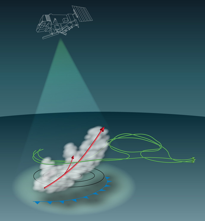
Virtual Workshop: Warm Conveyor Belts – a challenge to forecasting
#WCBWS
Due to the measures associated with the COVID-19 virus, this workshop was held virtually for all external participants.
Workshop description
Warm Conveyor Belts (WCBs) are cloudy regions of ascent and strong diabatic forcing along the cold front of a synoptic depression. They can lead to heavy local precipitation and can have downstream impacts such as the onset and maintenance of blocking. They are therefore important in both weather and climate prediction. However, WCBs are also associated with inherently increased error growth-rates, and are difficult to constrain in analyses - due partly to clouds having a strong non-linear impact on satellite observations and moist processes leading to larger model errors. Indeed, forecast “busts” are often associated with the existence of WCBs. In the climate text, model deficiencies in WCBs and in their large-scale drivers are likely to be particularly relevant; with implications for the future statistics of precipitation, heatwaves and droughts for example. This workshop brought together observation, assimilation, model, forecast and research communities to explore these aspects. The aim was to improve understanding and to help develop optimal strategies to improve weather and climate prediction - a goal which would be very difficult for a single such community to achieve on its own. The workshop included invited and submitted talks, and had a strong focus on posters.
Programme and key questions
1. WCBs and downstream impacts
What do we know about the formation, dynamics and physics of WCBs and their downstream impacts? Is convection and upscale error growth important for the evolution and predictability of WCBs – with implications for the scales we need to represent in the model and constrain in data assimilation? Relationship to Atmospheric Rivers. Conceptual models.
2. Observations
Numerical weather prediction assimilates a wealth of observations; some sensitive to cloud and precipitation through the use of "all sky" methods. What are the key observations which currently constrain WCBs? What are the limits to how well they could constrain the relevant scales and parameters? Do WCBs strengthen the case for additional observations in future? EarthCARE, Aeolus. Learn from NAWDEX and AR campaigns.
3. Models and model uncertainty
How well do model climates represent the dynamics and physics of WCBs? What are the key sensitivities in model formulation and resolution (in the absence of initialisation)? Comparison with observations and reanalyses. Multi-model comparisons. Formulation and impact of model uncertainty.
4. Data assimilation
While WCBs might not highlight useful developments in DA methodology per se, there is a lot that diagnostics of data assimilation can tell us. How well do current assimilation schemes constrain WCBs? Where might the largest achievable improvements be made amongst the prior (background), model (non-linear, tangent linear and model uncertainty) and observational components? Ensemble data assimilation. Adjoint sensitivity. Forecast Sensitivity - Observation Impact (FSOI). Initial process tendencies and analysis increments. Multi-analysis comparisons.
5. Weather forecasting
How well are the dynamical evolution (including downstream impacts) and physical aspects predicted at present? Comparison with observational campaign data. Evaluation of ensemble forecast reliability, refinement and sharpness. Role of model uncertainty. What are the limits and challenges? Multi-model comparisons of ensemble forecasts (including TIGGE).
6. Climate variability and change
From observations/reanalyses what broader-scale features are associated with variations in WCB statistics? How well do models at seasonal/climate resolution represent these links? What can we infer about the statistics of WCBs (and their downstream impacts) in seasonal/climate predictions?
7. Break out groups and plenary
Further consideration of the above questions (in the light of talks and posters) and report back.
Organising committee
Stephen English, Laura Ferranti, Richard Forbes, Christian Grams, David Lavers, Linus Magnusson, Mark Rodwell, Irina Sandu, Heini Wernli
-
- 09:00 → 09:10
-
09:10
→
10:10
Session 1Convener: David Richardson (ECMWF)
-
09:10
An overview on the concept of warm conveyor belts 25m
Warm conveyor belts (WCBs) are coherent moist airstreams in extratropical cyclones that ascend from the (oceanic) boundary layer to the upper troposphere. The ascent of typically more than 600 hPa within 1-2 days is accompanied by a strong poleward motion of more than 2000 km, intense cloud formation, latent heating and precipitation. From a dynamical perspective, WCBs are also important because their associated latent heating leads to a production of potential vorticity (PV) in the lower troposphere and the creation of a negative anomaly of PV in the upper-tropospheric outflow of the WCBs. From a climate perspective one of their key aspects is the complex cloud evolution, which involves warm clouds at low levels, mixed-phase clouds in the mid-troposphere and ice clouds in the upper-tropospheric outflow regions. In this introductory overview presentation, after a brief history of the concept of WCBs, the following key aspects of WCBs will be discussed: (i) WCBs are frequent flow features in mid-latitudes, in particular over the North Atlantic and North Pacific storm tracks, (ii) WCBs produce a large fraction of extratropical precipitation and are involved in many extreme precipitation events, (iii) WCBs are associated with high values of midlatitude ice water content and lead to a strong cloud radiative forcing, (iv) WCBs are dynamically important because they can influence the intensity of the cyclone and of the upper-level ridge building, (v) the slantwise ascent within WCBs can be intercepted by embedded convection, and (vi) WCB are often involved in situations with increased forecast uncertainty.
Speaker: Heini Wernli (ETH Zurich) -
09:35
Aspirations for the workshop - Bringing WCB understanding into forecast system development 25m
This talk is largely about butterflies, of the Lorenz variety. In the ECMWF model, Warm Conveyor Belts (WCBs) not only lead to downstream developments such as the formation of blocking, they also act to strongly enhance downstream forecast uncertainty. In this way, WCBs can be thought of as Lorenz-type butterflies on the model's attractor. (A generalisation of the question "Does the flap of a butterfly's wings in Brazil set off a tornado in Texas?"). Interestingly, often the forecast models within the "TIGGE" archive do not agree on where the butterflies should be. Hence, there is a lot to learn about WCBs, and progress to be made in the practical realm of ensemble forecasting.
So why does a WCB act like a butterfly? Taking a single case-study (so far) in the ECMWF, we find that the representation of model uncertainty is a major factor in the increase in downstream uncertainty. The lack of a firm physical basis for the formulation of model uncertainty leads to different approaches at different forecasting centres, and this could well explain the different butterflies. Of course, we could all adopt the same representation of model uncertainty and our models may then put the butterflies in the same locations, but would they be right? A variance budget of the ensemble of data assimilations could help here because it can tell us if forecast uncertainty is consistent with forecast and observation errors. For the ECMWF model, there is some suggestion that the model is under-spread in a composite of WCB situations. Hence, in general, the presence of a WCB is likely to lead to poorer downstream forecast reliability.
This might be partly over-come at short lead-times in the ECMWF ensemble forecast by the application of singular vector perturbations to the initial conditions, which are shown to still have a strong positive impact on forecast uncertainty, even though the perturbation magnitudes have decreased over the years. Other experiments with the same case study suggest that the growth-rate can increase when the cloud scheme is given more of the work otherwise done by the convective parametrization. This suggests that the butterflies may be sensitive to model resolution.
In addition to such opportunities for forecast improvement from modelling development (better representation of the butterflies), we should also consider the forecast sharpness associated with better observational information. Ensemble forecast sensitivity to initial conditions suggests that a better analysis of the large-scale waves would help here - possibly by reducing the uncertainty of baroclinic development as well as of the embedded convection. These sensitivity results and data denial experiments suggest that observations and the analysis local to the WCB are also important.
While I will go quite quickly over these results, I hope that they will highlight some of the challenges we need to overcome if WCB understanding is to help improve forecast performance. Hopefully they provide some justification for the key questions of the workshop:
-
What are the key aspects of WCBs which lead to enhanced forecast uncertainty, and the implications for development strategy?
-
How well do we observe and initialise WCBs in our forecasts, and would new observation sources help?
-
How well do we represent the complex set of physical processes within a WCB, and what aspects deserve particular attention?
-
What role do WCBs play in weather extremes, regime transitions, and global climate?
Speaker: Dr Mark Rodwell (ECMWF) -
-
09:10
-
10:10
→
10:25
Break 15m
-
10:25
→
11:55
Session 2Convener: David Richardson (ECMWF)
-
10:25
Airborne active remote-sensing observations of warm conveyor belts 25m
This presentation summarizes the key findings using airborne observations with active remote-sensing instruments that were applied to observe WCBs. A focus is put on observations that were made during the North Atlantic Waveguide and Downstream impact EXperiment (NAWDEX) that was conducted in autumn 2016 with the aim to examine the structure of the jet stream, the impact of diabatic processes on the jet stream disturbances and their influence on high-impact weather downstream.
On the one hand we present NAWDEX cases with warm conveyor belt measurements highlighting uncertainties in the representation of wind and moisture across the tropopause in the outflow region of WCBs. WCB outflows are known to be of crucial relevance for mid-latitude atmospheric dynamics as wind fields are essential for the distribution of potential vorticity and thus the behaviour of Rossby waves. Moisture is important as the strong gradients across the tropopause may impact the mid-latitude flow through radiative heating processes. On the other hand we present lidar observations of the boundary layer humidity structure in the inflow region of a WCB providing the characteristic of an atmospheric river-type flow over the central Atlantic Ocean.
Additionally, this presentation is looking ahead to future field campaigns with the aim to excite a discussion on possible collaborations with the WCB community.
Speaker: Andreas Schäfler (DLR) -
10:55
Embedded convection in the warm conveyor belt of a North Atlantic cyclone and its relevance for large-scale dynamics 25m
The strong diabatic processes during warm conveyor belt (WCB) ascent modify the potential vorticity (PV) distribution, which can subsequently influence the large-scale flow evolution. According to the classical concept, WCBs rise continuously from the boundary layer to the upper troposphere with ascent rates of less than 50 hPa/h and thereby predominantly form stratiform clouds. Recent studies identified mesoscale embedded convection in the large-scale WCB ascent region with faster ascent rates. However, its dynamical significance and role for surface precipitation have not yet been analysed systematically.
We present a detailed case study of embedded convection in the WCB of a North Atlantic cyclone that occurred during the NAWDEX campaign. Satellite observations and online trajectories from a high-resolution convection-permitting model simulation consistently suggest that convection, with ascent rates exceeding 100-200 hPa/h, is embedded in extended areas of the large-scale WCB ascent.
Composites along the convectively ascending WCB trajectories show locally enhanced surface precipitation rates and large hydrometeor contents, including the formation of graupel and high cloud tops. Moreover, the composites reveal the formation of strong low-level positive and upper-level negative PV anomalies along the convective ascent, which are substantially stronger than the PV anomalies formed by the 'classical' more slowly ascending WCB trajectories. On the mesoscale, the composites show the formation of diabatically-produced horizontal upper-level PV dipoles centered around the convective WCB ascent, similar to the formation of PV dipoles in convective storms in a sheared environment. These mesoscale PV dipoles are associated with coherent wind anomalies, a cyclonic and anticyclonic circulation anomaly around the positive and negative PV poles, respectively. On the large-scale, these convectively-produced mesoscale PV dipoles aggregate to elongated PV dipole bands aligned with the elongated convective region and the vertical wind shear vector. Several examples of such PV dipole bands illustrate that the negative pole can interact with the upper-level waveguide, influence the jet stream and lead to jet streaks downstream.
Altogether, our detailed analysis of WCB ascent provides new insights into the characteristics of the WCB ascent and its embedded convection and highlights the potential of embedded mesoscale convection for the modification of the meso- and larger-scale circulation and the downstream flow evolution.Speaker: Annika Oertel (ETH Zurich) -
11:25
The importance of warm conveyor belts for (upscale) error growth 25m
This presentation introduces a quantitative potential-vorticity (PV) framework to quantify the processes governing the amplification of forecast errors and forecast uncertainty. The framework is based on the well-established PV perspective of midlatitude dynamics. A tendency equation is derived for error-potential enstrophy and applied to a series of numerical upscale error-growth experiments, in which the only difference between the ensemble members lies in the random seed of the stochastic convection scheme. Our analysis identifies distinct stages of error growth: In the first 12h, latent-heating differences induced by the convection scheme dominate the error growth near the tropopause. In the following 1.5 days, the dominant error-growth contribution is given by upper-tropospheric divergence displacing the strong midlatitude PV gradient. After two days, differences in the nonlinear Rossby-wave dynamics near the tropopause dominate the error growth. Prominent upper-tropospheric divergence is often associated with warm conveyor belts (WCBs). Our analysis thus indicates that WCBs play an essential role for upscale error growth by projecting errors from moist processes into the tropopause region.
The results from the upscale error-growth experiments are compared with the amplification of forecast uncertainty in an operational ensemble forecast covering the NAWDEX Golden Case “Karl”. With a newly developed framework, we quantify the contributions of individual processes to the evolution of ensemble spread. Averaged over the midlatitudes of the Northern Hemisphere, the amplification of ensemble spread is dominated by near-tropopause dynamics, highlighting that the uncertainty related to the initial conditions is still larger than the uncertainty related to moist processes. Locally, however, there can be large differences as in the region where tropical storm Karl interacts with the Rossby-wave pattern during extratropical transition. In this region, the variance amplification is mostly related to the moist baroclinic cyclone development, including strong upper-tropospheric divergence, which again indicates a prominent role of WCB development for projecting forecast uncertainty onto the large-scale circulation.Speaker: Dr Michael Riemer (Johannes Gutenberg-Universität Mainz)
-
10:25
-
11:55
→
13:55
Poster lunch 2h
-
13:55
→
15:15
Session 3Convener: Linus Magnusson (ECMWF)
-
13:55
The role of cloud diabatic processes in the life cycle of Atlantic-European weather regimes 20m
Weather regimes are quasi-stationary, persistent, and recurrent states of the large-scale extratropical circulation. In the Atlantic-European region these explain most of the atmospheric variability on sub-seasonal time scales. However, current numerical weather prediction (NWP) systems struggle in correctly predicting weather regime life cycles. Latent heat release in ascending air streams injects air into the upper troposphere, which might ultimately result in blocking. Such diabatic outflow is often linked to warm conveyor belt (WCB) activity and has been shown to be involved in upscale error growth up to the regime scale. This study systematically investigates the role of diabatic outflow in the life cycle of Atlantic-European weather regimes.
An extended definition of 7 year-round Atlantic-European weather regimes from 37 years of ERA-Interim reanalysis is used. This is based on an EOF analysis and k-means clustering of normalized low-pass-filtered 500hPa geopotential height anomalies. Furthermore an objective regime life cycle is derived. The role of cloud-diabatic processes in European weather regimes is assessed based on time lag analysis of WCB activity at specific life cycle stages.
Results indicate that the period prior to regime onset is characterized by important changes in location and frequency of WCB occurrence. Most importantly, prior to the onset of regimes characterized by blocking, WCB activity increases significantly upstream of the incipient blocking even before blocking is detectable and persists over the blocked region later. This suggests that diabatic WCB outflow helps to establish and maintain blocked regimes. Thus it is important to correctly represent cloud-diabatic processes in NWP models across multiple scales in order to predict the large-scale circulation accurately. Ongoing work now systematically investigates the representation of WCB activity in current NWP systems and how this relates to the forecast skill for weather regimes.Speaker: Christian M. Grams (IMK-TRO, Karlsruhe Institute of Technology (KIT)) -
14:20
Examining model error in potential temperature and potential vorticity via weather forecasts at different lead times 20m
The examination of model error is fundamental to improve weather forecasts at any time scale. In this contribution, model error in potential temperature and potential vorticity (PV) is analysed through the examination of 12-h and 24-h forecasts at the grid-point level using an Eulerian approach and another based on the use of diabatic tracers of potential temperature and PV. Diabatic tracers enables a more detailed investigation of the Eulerian results by decomposing the total Eulerian changes into materially-conserved and diabatically-generated components. This analysis is particularly relevant for warm conveyor belt systems, characterised by a strong diabatic influence on their environment. The approach taken throughout this work consists of considering the behaviour of a theoretical unbiased model, for which the only assumption is that forecast error is zero when averaged over a large number of cases, as a reference. Deviations from this theoretical behaviour are used to highlight conditions leading to large errors. The analyses are performed on forecasts produced with the Met Office Unified Model during the NAWDEX field campaign in autumn 2016. The Eulerian approach indicates that changes in potential temperature and PV are underestimated with respect to the theoretical behaviour of an unbiased model. The grid points with the largest changes in 12-h forecasts have the largest underestimation in the 24-h forecast, highlighting the importance of the underestimation for grid points corresponding to the location of warm conveyor belt outflows. The Lagrangian-tracer investigation reveals very large deviations from the theoretical behaviour of an unbiased model regardless of the level of Eulerian change, in particular for PV, and an unrealistic similarity in magnitude between parametrised diabatic changes of PV in the forecasts. Addressing the deviations from the behaviour of a theoretical unbiased model found in this work could be a step forward towards an operational unbiased model.
Speaker: Oscar Martinez-Alvarado (National Centre for Atmospheric Sciences, University of Reading) -
14:45
The Impact of Warm Conveyor Belt Forecast Uncertainty on Variability in the Downstream Waveguide 25m
Atmospheric waveguides denote the location of the jet stream and constrain the motion of Rossby waves. Perturbations of the waveguide, such as those associated with the warm conveyor belt (WCB) of midlatitude cyclones, can lead to the downstream radiation of Rossby waves, which can often spawn high-impact extreme weather events. Previous studies have hypothesized that forecast errors associated with diabatic heating within WCBs may lead to variability in the downstream waveguide; however it is unclear to what extent this may be true.
This study evaluates the hypothesis that mesoscale uncertainty associated with the WCB plays an outsized role in introducing downstream forecast errors along the midlatitude waveguide. The above hypothesis is evaluated by applying the ensemble-based sensitivity technique to Model for Prediction Across Scales (MPAS) ensemble forecasts of five North Atlantic cyclones characterized by a significant waveguide perturbation. This hypothesis is assessed by comparing the sensitivity of downstream forecasts to the divergent outflow as well as other features, such as the position of upstream troughs or details of the waveguide itself. In addition, the ensemble’s evolution of the downstream state is evaluated by computing a robust potential vorticity (PV) budget, which quantifies the unique contributions to downstream PV from diabatic heating and from advection of PV by the divergent and non-divergent flow. Finally, the sensitivity and PV budget analyses are confirmed using several perturbation experiments, which involve modifying the MPAS initial conditions within the sensitive regions associated with the WCB and upstream waveguide.
Speaker: Jeremy Berman (University at Albany, SUNY)
-
13:55
-
15:15
→
15:30
Break 15m
-
15:30
→
17:15
Session 4Convener: David Lavers (ECMWF)
-
15:30
Linking atmospheric rivers and warm conveyor belt airflows 20m
Extreme precipitation associated with extratropical cyclones can lead to flooding if cyclones track over land. However, the dynamical mechanisms by which moist air is transported into cyclones is poorly understood. In this paper we analyze airflows within a climatology of cyclones in order to understand how cyclones redistribute moisture stored in the atmosphere. This analysis shows that within a cyclone’s warm sector the cyclone-relative airflow is rearwards relative to the cyclone propagation direction. This low-level airflow (termed the feeder airstream) slows down when it reaches the cold front, resulting in moisture flux convergence and the formation of a band of high moisture content. One branch of the feeder airstream turns toward the cyclone center, supplying moisture to the base of the warm conveyor belt where it ascends and precipitation forms. The other branch turns away from the cyclone center exporting moisture from the cyclone. As the cyclone travels, this export results in a filament of high moisture content marking the track of the cyclone (often used to identify atmospheric rivers). We find that both cyclone precipitation and water vapor transport increase when moisture in the feeder airstream increases, thus explaining the link between atmospheric rivers and the precipitation associated with warm conveyor belt ascent. Atmospheric moisture budgets calculated as cyclones pass over fixed domains relative to the cyclone tracks show that continuous evaporation of moisture in the precyclone environment moistens the feeder airstream. Evaporation behind the cold front acts to moisten the atmosphere in the wake of the cyclone passage, potentially preconditioning the environment for subsequent cyclone development.
Speaker: Dr Helen Dacre (University of Reading) -
15:55
Influence of Warm Conveyor Belts on the Predictability of Downstream High-Impact Weather 25m
We explore the sensitivity and predictability of warm conveyor belts (WCBs) within extratropical cyclones that were observed intensively during the North Atlantic Waveguide and Downstream Impact Experiment (NAWDEX) in the fall of 2016. We utilize the moist adjoint for the Coupled Ocean-Atmosphere Mesoscale Prediction System (COAMPS) to quantify the initial state and forecast sensitivity, as well as identify predictability barriers associated with moist and diabatic processes within WCBs. The adjoint modeling system is used to understand how perturbations of moisture, winds and temperature, of similar magnitude as analysis errors, impact WCBs and the cyclones, and subsequently grow rapidly as they propagate downstream as they interact with the waveguide.
The first case we focus on is the extratropical transition (ET) of Karl (2016) and its interaction with the waveguide and subsequent downstream impact. Karl is a unique storm in that it was observed as a tropical cyclone during two flights of the NASA Global Hawk (22-23 Sept. and 24-25 Sept.) as part of the NOAA Sensing Hazards with Operational Unmanned Technology (SHOUT) program. The subsequent extratropical transition (ET) of ex-Karl was observed by the European HALO G-V aircraft (26 Sept.) during NAWDEX. The adjoint sensitivity results underscore the importance of the inflow to the WCB during the ET stage of ex-Karl. The adjoint diagnostics indicate that the intensity of the WCB in ex-Karl following ET was especially sensitive to the northeast of Karl in a corridor of moisture prior to ET, and approximately 48-h earlier when the Global Hawk was observing the storm. We also find that the intensity of diabatic heating in the WCB influences the downstream ridge development. We use the Global Hawk dropsondes in the vicinity of Karl, as well as HALO dropsondes and the WALES DIAL Lidar to characterize the regions of strong sensitivity including those within the WCB.
Immediately following the ex-Karl ET case, extratropical cyclone ‘Walpurga’ developed and featured strong water vapor transport. This cyclone and associated atmospheric river were observed by a HALO flight on 27 September. The adjoint sensitivity highlights regions of enhanced sensitivity filaments of water vapor and temperature located in the low- to mid-levels within the ascending portion of an atmospheric river that have a strong impact on a high-impact precipitation event in Scandinavia that resulted in more than 100 mm in 72 h. Additionally, the adjoint results connect the high-impact precipitation event to the WCB associated with ex-Karl. The results of this study underscore the need for higher-fidelity moisture observations particularly within WCBs along with data assimilation systems that can adequately assimilate these mesoscale observations in order to reduce the forecast uncertainties for cyclones and their associated downstream impact.
Speaker: Dr James Doyle (Naval Research Laboratory) -
16:25
West Coast Forecast Challenges and Development of Atmospheric River Reconnaissance 20m
Water management and flood control are major challenges in the Western U.S. They are heavily influenced by atmospheric river (AR) storms that produce both beneficial water supply and hazards, e.g., 84 % of all flood damages in the West (up to 99% in key areas) are associated with ARs. However, AR landfall forecast position errors can exceed 200 km at even 1-day lead time and yet many watersheds are <100 km across, which contributes to issues such as the 2017 Oroville Dam spillway incident and regularly to large flood forecast errors. Combined with the rise of wildfires and deadly post-wildfire debris flows, such as Montecito (2018), the need for better AR forecasts is urgent.
AR Recon was developed as a research and operations partnership to address these needs. It combines new observations, modeling, data assimilation and forecast verification methods to improve the science and predictions of landfalling ARs. ARs over the northeast Pacific are measured using dropsondes from up to three aircraft simultaneously. Additionally, airborne radio occultation is being tested, and drifting buoys with pressure sensors are deployed. AR targeting and data collection methods have been developed, assimilation and forecast impact experiments are ongoing, and better understanding of AR dynamics is emerging.
AR Recon is led by the Center for Western Weather and Water Extremes and NWS/NCEP. Core partners are Navy, Air Force, NCAR, ECMWF and academia. It is included in the “National Winter Season Operations Plan,” to support improved outcomes for emergency preparedness and water management in the West.Speaker: Marty Ralph (Center for Western Weather and Water Extremes, Scripps Institution of Oceanography, University of California San Diego) -
16:50
Adjoint Sensitivity and the Impact of Atmospheric River Reconnaissance Observations for North Pacific Forecasts 20m
We will briefly summarize the results from two related studies. In the first study, the initial-state sensitivity and optimal perturbation growth for 24- and 36-h forecasts of low-level kinetic energy and precipitation over California during a series of atmospheric river (AR) events that took place in early 2017 are explored using adjoint-based tools from the Coupled Ocean–Atmosphere Mesoscale Prediction System (COAMPS). This time period was part of the record-breaking winter of 2016–17 in which several high-impact ARs made landfall in California. The adjoint sensitivity indicates that both low-level winds and precipitation are most sensitive to mid- to lower-tropospheric perturbations in the initial state in and near the ARs. A case study indicates that the optimal moist perturbations occur most typically along the subsaturated edges of the ARs, in a warm conveyor belt region. The sensitivity to moisture is largest, followed by temperature and winds. In an average sense, the sensitivity and related optimal perturbations are very similar for the kinetic energy and precipitation response functions. However, case-by-case differences suggest that optimal adaptive observing strategies should be metric dependent. The positive correlation between sensitivity magnitude and forecast error supports the relevance of adjoint-based calculations for predictability studies.
In the second study, we examine the impact of assimilating dropsonde observations collected during the AR 2018 field program on the Navy Global Environmental Model (NAVGEM) analyses and forecasts. We compare NAVGEM’s representation of the ARs to the observations, and examine whether the observation-background difference statistics are similar to the observation error variance specified in the data assimilation system. Forecast Sensitivity Observation Impact is determined for each dropsonde variable, and compared to the impacts of the North American radiosonde network. We find that the reconnaissance soundings have significant beneficial impact, with per observation impact more than double that of the North American radiosonde network. Temperature and wind observations have larger total and per observation impact than moisture observations. In our experiment, the 24-h global forecast error reduction from the reconnaissance soundings can be comparable to the reduction from the North American radiosonde network for the field program dates that include at least two flights. In data denial experiments, the relative differences between the NAVGEM and ECMWF analyses decrease by up to 11% when the AR dopsondes are assimilated, but a systematic decrease in standard forecast error metrics over North America is difficult to detect.
Speaker: Dr Carolyn Reynolds (Naval Research Laboratory)
-
15:30
-
17:15
→
17:35
Workshop photo - Bluejeans Gallery 20m
-
-
09:00
→
10:30
Session 5Convener: Stephen English (ECMWF)
-
09:00
How well do current observations observe key features of warm conveyor belts? 25m
In this presentation the key features of warm conveyor belts that need to be observed to characterise them correctly in the analysis are recalled. This includes the warm conveyor belt itself, with features such as elongated cloud bands, spiral and hook cloud formations, areas of intense latent heating and surface precipitation. But also associated features such as the dry intrusion and the cold conveyor.
It is well documented how such features appear in satellite imagery, but in order to ensure that the feature is well represented in the analysis, so that the forecast model can evolve it correctly, requires quantitative information on vorticity, shear, humidity gradients, clouds and precipitation. On occasion intensive observation campaigns can provide detailed observations to better understand processes and describe more fully these systems. But in this talk we examine what the current WMO Integrated Global Observing System (WIGOS) can provide that is relevant to warm conveyor belts, identifying strengths and weaknesses, including a specific gap analysis with respect to these processes. This can both inform what is needed in terms of the future evolution of the WIGOS, and also enable intensive observation campaigns to focus on what is most needed.
Speaker: Stephen English (ECMWF) -
09:30
Assimilation of water vapour, cloud and precipitation observations in extratropical cyclones 25m
Microwave radiances sensitive to water vapour, cloud and precipitation are assimilated in all-sky conditions with benefit to ECMWF forecasts into the medium range. In terms of an adjoint-based sensitivity measure (Forecast Sensitivity to Observation impact, FSOI) these observations provide around 20 % of all observational impact on the short-range forecast, so they are now one of the most important parts of the observing system. Every winter there are extratropical cyclones where the all-sky radiances have a disproportionate impact on the 24 h forecast improvement. Examining these case studies, the most influential observations are typically in cloudy regions over ocean when other observations are mostly unavailable. Modern data assimilation systems already provide detailed and accurate short-range forecasts of extratropical cyclones including their cloud and precipitation structures. Hence only small changes are needed between the background forecast and analysis, and these are on scales less than 500 km. However, the all-sky observations are able to make adjustments to cloud and moisture in the vicinity of the warm conveyor belt inflow which lead to significant downstream impacts on the developing extratropical cyclone.
Speaker: Alan Geer (ECMWF) -
10:00
The prospects for radars on satellites to provide better observations of warm conveyor belts 25m
Spaceborne radars have the potential to provide profiles of precipitation, clouds and winds within cloudy systems that are inaccessible from other satellite techniques. The reflectivity profiles from the nadir pointing cloud radar on CloudSat launched in 2006 have provided the first global data sets of cloud ice content within clouds and precipitation rates with 500m vertical and 1km horizontal resolution; this information has been a useful constraint for cloud parameterisation schemes within NWP and climate models. The EarthCARE satellite to be launched in 2022 will have a nadir pointing Doppler radar and high spectral resolution lidar and should to provide much more precise profiles of the microphysical and radiative cloud properties. ESA are studying a conically scanning Doppler cloud radar concept with a revisit time of about 12 hours, that should measure in-cloud winds, using the cloud droplets as tracers, with a resolution of 1km in the vertical and 20km in the horizontal, sufficient to resolve warm conveyor belts.
Speaker: Anthony Illingworth (University of Reading)
-
09:00
-
10:30
→
10:45
Break 15m
-
10:45
→
12:05
Session 6Convener: Tim Hewson (ECMWF)
-
10:45
How do diabatic processes in warm conveyor belts influence circulation and Rossby waves at tropopause level? 20m
Different mechanisms for the influence of diabatic heating on the dynamics of the jet stream include: i) radiative maintenance of potential vorticity (PV) contrast across the tropopause, ii) sharpening of jet stream maximum wind by the “non-advective PV flux”, iii) amplification of baroclinic wave growth rate through lower “effective static stability” and iv) diabatic mass transport into tropopause ridges. Latent heat release in warm conveyor belts (WCBs) is important to the last 3 mechanisms. This talk explores the fourth mechanism and uses Kelvin’s circulation theorem to argue that the primary diabatic influence is not a change to the value of PV in WCB outflow, but the additional transport of mass into higher isentropic layers and the associated expansion in ridge area. This results in a stronger anti-cyclonic flow anomaly as deduced through conservation of circulation. NAWDEX cases are used to quantify the effects in a variety of situations. It is shown that diabatic mass transport can achieve a change in large-scale flow configuration that is unlikely to occur in an adiabatic flow, and its relation to dipole block onset is discussed.
Speaker: John Methven (University of Reading) -
11:10
Revisiting the isentropic view of PV modification in warm conveyor belts 20m
Potential vorticity (PV) provides a conceptual stepping stone from diabatic heating rates in warm conveyor belts to their impact on the large-scale flow. Given the diabatic heating rates, the associated modification of the PV field can be computed and the resulting PV anomalies used to understand both the local intensification of the parent cyclone and any downstream impacts on the larger-scale Rossby wave in which it is embedded. Determining the impact of the heating rates on the PV field is almost always done from a Lagrangian perspective following air parcel trajectories: WCB trajectories typically start in the atmospheric boundary layer with low PV, their PV increases whilst beneath the heating maximum, reaches a maximum mid-ascent, and then reduces to low values again in the upper troposphere. This framework provides a conceptually simple extension to the usual interpretation of PV under adiabatic conditions. However, it is not the only option when diabatic heating is acting. Here we explore the equally-valid, but much less widely used, approach of following the evolution of PV along isentropic trajectories. This approach is appealing because it makes a closer connection with Kelvin's circulation theorem, but is it useful? We take a pragmatic view and ask: can anything be learnt from the isentropic framework that we don’t already know from air parcel trajectories?
Speaker: Ben Harvey (NCAS / University of Reading) -
11:35
Three-dimensional radiative transfer around a tropopause fold 25m
Tropopause folds are characterized by strong horizontal gradients of temperature, water vapor, and cloud. The two-stream radiation schemes used in almost all weather and climate models ignore this variability. Using the Monte Carlo code MYSTIC, we have computed thermal infrared heating rates for a two-dimensional cross-section of an upper-level front in a NAWDEX event, based on thermal and moisture fields generated by high-resolution simulations using the COSMO model. The impact of the horizontal radiative fluxes is surprisingly small.
Studies using idealized atmospheric cross-sections show that temperature gradients are the largest driver of net radiative cooling, however where the tropopause is vertical and the horizontal gradients in moisture variables are strongest, the horizontal temperature gradient is weak. This structure results from dynamical constraints: the maximum in isentropic PV gradient at the vertical tropopause is associated with a maximum in jet strength, which by thermal wind balance corresponds to a minimum in horizontal temperature gradient.Speaker: George Craig (Meteorological Institute, LMU Munich)
-
10:45
-
12:05
→
13:05
Lunch break 1h
-
13:05
→
14:20
Session 7Convener: Irina Sandu (ECMWF)
-
13:05
Rapid ascents embedded in a warm conveyor belt observed and modeled at kilometer-scale resolution 20m
During the NAWDEX field campaign, the RASTA Doppler radar aboard the French Falcon-20 provided unique cloud and wind measurements inside the warm conveyor belt (WCB) of the “Stalactite” cyclone. Vertical structures of high radar reflectivity—of ~20-km width and 2–4-km height—were observed embedded in a broad cloud structure extending over the whole troposphere. A low-level jet with wind speed above 35 m/s was found below at 1 km altitude, while the upper-level jet stream reached 45 m/s aloft.
A convection-permitting simulation using the Meso-NH model reproduces the observed structures well and highlights vertical velocities up to 0.5 m/s. A Eulerian budget analysis shows a peak in diabatic heating at 6–7 km altitude due to condensation and deposition on ice crystals within the WCB. Lagrangian trajectories computed online during a 12-h window allow identification of rapidly and slowly ascending WCB air masses. Rapid WCB ascents, as defined by a 2-h pressure decrease above 100 hPa, are associated with the vertical structures of high reflectivity and located behind the cold front. They are characterized by the presence of graupel and low static stability below the upper-level jet, while slow WCB ascents are found in the upper part of the broad cloud structure.
Extending the analysis to the whole simulation domain shows that one third of WCB trajectories exhibit phases of rapid ascent and confirms their preferred location at the cold-frontal edge of the WCB and at lower altitude than slow ascents, which are more widespread across the core of the WCB. The large majority of rapid ascents ends up in the cyclonic branch of the WCB but, compared to slow ascents, a larger fraction exhibits outflow with negative potential vorticity. This result suggests that rapid ascents impact the evolution of both the cyclone and the upper-level dynamics.
Speaker: Florian Pantillon (Laboratoire d'Aérologie) -
13:30
Impact of different microphysics on the warm conveyor belt of a deep extratropical cyclone observed during the NAWDEX campaign and on its associated ridge building. 20m
The present study investigates diabatic processes along the Warm Conveyor Belt (WCB hereafter) of a deep extratropical cyclone, called the Stalactite Cyclone, observed during the NAWDEX field campaign in fall 2016 over the North Atlantic. The ridge building during the development of the cyclone led to the formation of a large-scale Scandinavian blocking. It is therefore particularly important to study heating rates along the WCB as it directly affects the ridge building and blocking formation. To do so, two simulations of the French research model Méso-NH with a 2.5-km resolution are performed with two different microphysics schemes: the one-moment scheme ICE3 and the two moment scheme LIMA. The LIMA scheme includes a prognostic evolution for the hydrometeor concentrations while the ICE3 scheme does not, and there is also a difference in the treatment of ice supersaturation. Both simulations show a good representation of the dynamic of the Stalactite Cyclone in comparison with NAWDEX observations (Doppler cloud radar on board the SAFIRE Falcon-20, dropsondes and satellite data). However, the model seems to produce less cold species (ice, snow, graupel) than the observations show and differences are noticed between the two simulations (as shown with reflectivities on the figure). They are then compared by computing WCB Lagrangian trajectories and analyzing the budget of the diabatic heating rate along them. Largest differences in the heating rate between the two simulations come from the microphysical processes and the relative concentration of the cold species. The LIMA scheme produces less ice but more snow and graupel, leading to a different vertical profle of latent heat release compared to the ICE3 scheme. More WCBs are found to reach the upper troposphere for ICE3 simulation compared to LIMA simulation and this already creates PV differences along the edge of the tropopause between the two simulations after 24 hour. Smaller PV values are found in the WCB outflow regions for the ICE3 simulation which have some consequences for the ridge building. However, both simulations tend to underestimate the ridge building compared to the Arpège operational analysis.
Speaker: Dr Marie Mazoyer (CNRM, Météo-France/CNRS, Toulouse, France) -
13:55
Diabatic processes in the Warm Conveyor Belt of the Stalactite Cyclone: sensitivity to two convective parametrization schemes of the global Météo-France model ARPEGE 20m
The main goal of this study is to analyze the representation of the Stalactite Cyclone warm conveyor belt (WCB) in the global Météo-France model ARPEGE. Two simulations, each using one of the two different deep convection parametrization schemes developed in ARPEGE are compared. The first one is the Bougeault’s scheme, developed in 1985 and the second one is based on grid-scale budget equations separating microphysics and transport terms (PCMT, Piriou et al., 2007).
The Stalactite Cyclone is an extratropical cyclone (29 Sept-2 Oct 2016) that has been intensively observed during the international field campaign NAWDEX. As its later stage of development was closely associated with the onset of a low-predictable European blocking event, it is particularly interesting to study the model skills in representing the associated WCB dynamics. Two flights of the SAFIRE Falcon equipped with the RALI platform have been performed in the ascending and outflow regions of this WCB. The RALI platform is composed of a Doppler radar RASTA and a three-wavelength backscatter lidar LNG. Observations and model outputs are compared in terms of the horizontal wind speed derived from the Doppler radar RASTA and of the ice water content retrieved from the RALI observations. All of these observations provide indirect informations about diabatic heating rates along the WCB and their impacts on the dynamics through potential vorticity modification.
Lagrangian trajectories are computed for each simulation and those satisfying the WCB criteria are selected. The heating associated to the transition toward the liquid phase is higher with PCMT convection scheme while the transition toward the ice phase is more important in Bougeault's one. Futhermore, more WCB trajectories with anticyclonic curvature are found using Bougeault scheme
and they reach, in average, higher isentropic levels. This explains the lower values of potential vorticity found in the upper isentropes with this deep convection scheme. Potential vorticity modification along WCB trajectories differs between the two simulations due to sensible and latent heat differences during their ascents. Finally, both parametrizations strongly underestimate the ice water content retrieved from the remote sensing observations. Bougeault's deep convection scheme has slightly more ice water content in the upper troposphere than the Piriou’s one, and in that sense, is slightly closer to the observations. This is in agreement with the slightly stronger upper-level heating rate due to ice phase transition detected in the Bougeault’s WCB trajectories.Speaker: Gwendal Riviere (LMD/IPSL, ENS, CNRS)
-
13:05
-
14:20
→
14:35
Break 15m
-
14:35
→
16:00
Session 8Convener: Irina Sandu (ECMWF)
-
14:35
Microphysics and dynamics of snowfall associated to a warm conveyor belt over Korea 25m
On 28 February 2018, 57 mm of precipitation associated to a warm conveyor belt (WCB) fell within 21 h over South Korea. To investigate how the large-scale circulation influenced the microphysics of this intense precipitation event, we used radar measurements, snowflake photographs and radiosounding data from the International Collaborative Experiments for Pyeongchang 2018 Olympic and Paralympic winter games.
The WCB was identified with trajectories computed with analysis wind fields from IFS. Supercooled liquid water (SLW) with concentrations exceeding 0.2 $\mathrm{g\,kg^{-1}}$ was produced during the rapid ascent within the WCB. The SLW droplets eventually freeze to form ice crystals, which grow by vapour deposition in the outflow of the WCB, where the ice supersaturation is above 10$\%$. This depositional growth above 5000 m a.s.l. is confirmed by polarimetric radar measurements. The WCB was collocated with a zone of enhanced wind speed of up to 45 $\mathrm{m\,s^{-1}}$ at 6500 m a.s.l., as measured by a radiosonde and a Doppler radar. Below this maximum of wind speed, a strong vertical wind shear creates turbulence. The precipitating crystals aggregate in this turbulent layer and experience riming by accretion of SLW droplets, which was confirmed by snowflake photographs at ground level. Furthermore, vertical Doppler velocity measurements suggest the presence of embedded convection with updraughts of 3 $\mathrm{m\,s^{-1}}$, which lift particles and produce more SLW, enhancing both aggregation and riming. This case study shows how a WCB provides ideal conditions for rapid precipitation growth involving SLW production, riming and aggregation. For accurate precipitation forecasts, atmospheric models need to correctly simulate the flow conditions in WCBs and properly parametrise the involved microphysical processes.Speaker: Josué Gehring (EPFL) -
15:05
The effect of clouds, radiation and turbulence on upper-level PV 25m
The dynamics of extratropical cyclones entails several important near-tropopause flow features, including sharp PV gradients and jet streaks, deep troughs and tropopause folds (positive PV anomalies) and the formation of large pole- and upward expanding ridges (negative PV anomalies). The evolution of these PV features are modified by non-conservative processes, such as cloud latent heating, radiative transfer and turbulence, which are represented by parameterizations in numerical weather prediction models.
Using a Lagrangian method, material PV modification and PV anomalies near the tropopause are attributed to specific parameterized processes in the global model of the ECMWF, both in a case study and systematically over a winter season.The results suggest that turbulence is a key process for modifying PV on the mesoscale near strong upper-level jets, with direct implications for horizontal and vertical PV gradients and PV anomalies near the tropopause, and for stratosphere-troposphere exchange.
Diabatic PV anomalies generated by cloud processes are primarily found on the synoptic scale in warm conveyor belt outflows and related to cloud formation in regions of a lowered tropopause, exhibiting strong case-to case variability. Their role for near-tropopause PV depends crucially on the properties of the WCB, such as the outflow height.
Radiative PV modification near the tropopause is typically weak in terms of instantaneous PV tendencies and acts at longer time scales, but is distributed more homogeneously across large regions and therefore adds a major contribution to the PV budget in a time- or domain-averaged perspective. It is shown that the lower stratospheric PV production strongly depends on the presence of clouds.The particular strengths of the Lagrangian trajectory-based diagnostic used in this study are that it connects prominent tropopause structures that are relevant for the dynamics of extratropical weather systems with non-conservative PV modification along the flow, and that it quantifies the relative importance of parameterized turbulence, radiation and cloud processes for these modifications.
Speaker: Heini Wernli (ETH Zurich) (presenting for Elisa Spreitzer, ETH Zurich) -
15:35
Linking Predictability barriers and diabatic processes 20m
Several case studies have tracked down large medium range NWP errors over the North Atlantic to minor errors in the representation of diabatic processes occurring in mesoscale structures. Different stages of error growth have been identified including: convective instability, the influence of divergent outflow on the tropopause position and interactions between disturbances at tropopause level and Rossby wave packet development.
The links between diabatic processes and “Predictability barriers’’, defined as the rapid growth of ensemble spread and even faster growth of error growth of certain validation times (consistently across a range of lead times), are explored and identified with events during the North Atlantic Waveguide and Downstream impact Experiment (NAWDEX).
A semi-geostrophic balance tool is used to attribute the response of the 3-D ageostrophic flow to geostrophic and diabatic forcing, enabling a novel diagnostic for Diabatically-Induced Ageostrophic Advection of potential vorticity (DIAA). Finally, evidence is shown that predictability barriers are linked to events with strong diabatic influence on tropopause advection. Error growth exceeds ensemble spread rate by approximately 4/3 during strong DIAA events, showing that predictive skill is considerably lower in these situations.Speaker: Claudio Sanchez (MetOffice)
-
14:35
-
16:00
→
16:15
Break 15m
-
16:15
→
17:30
Session 9Convener: David Lavers (ECMWF)
-
16:15
Impact of model upgrades on diabatic processes in extratropical cyclones and downstream forecast evolution 20m
Models are continuously developed at numerical weather prediction (NWP) centres to improve forecast skill, with new operational model configurations adopted every few years. The parameterisations of diabatic processes are probably the most frequently updated part of NWP models as they are crucial for accurate weather predictions and contain uncertainties in their formulation. The impact of model developments is assessed here in forecasts from the Met Office’s weather forecast model initialised throughout the North Atlantic Waveguide and Downstream Impact Experiment field campaign period in autumn 2016. Planned model parameterisation developments are considered, together with an ‘inexpensive coupled’ forecast with daily updating of the sea surface temperature and sea-ice fraction.
Forecasts produced from the coupled system have, on average, indistinguishable skill from the control forecasts, suggesting the benefits of coupled atmosphere-ocean NWP systems can be small. In contrast, a reduction in forecast error (~4%) is identified in forecasts produced using an upgraded convection scheme. Periods of low forecast skill during the study period are shown to be associated with the onset and decay of blocking events and increased diabatic heating of air masses reaching the upper troposphere. In forecasts of a specific block development case that was not accurately predicted in any of the experiments or in the operational ensemble forecast from the Met Office, the representation of diabatic heating in the warm conveyor belt of an upstream cyclone is shown to moderate the subsequent block development: forecasts in which the heating is stronger generally have a more-amplified blocking ridge and amplified heating contributions from all parameterisations as diagnosed using diabatic tracers. Hence, we demonstrate that plausible changes to the representation of several different diabatic processes in models can impact forecast block development via changes within upstream cyclones.
Speaker: Suzanne Gray (Department of Meteorology, University of Reading) -
16:40
GPM Satellite Radar Observations of Precipitation Mechanisms in Atmospheric Rivers 20m
Despite numerous studies documenting the importance of atmospheric rivers (AR) to the global water cycle and regional precipitation, the evolution of their water vapor fluxes has been difficult to investigate given the challenges of observing and modeling precipitation processes within ARs over the ocean. This study uses satellite-based radar reflectivity profiles from the Global Precipitation Measurement Dual-Frequency Precipitation Radar (GPM-DPR), combined with kinematic and thermodynamic conditions in the vicinity of the precipitation diagnosed from the Climate Forecast System Reanalysis, to evaluate the characteristics and dynamical origins of precipitation in ARs that occurs upstream of warm conveyor belt ascent. Transects of 192 ARs over the Northeast Pacific Ocean between 2014 and 2018 are examined. Both stratiform and convective precipitation were abundant in these GPM transects and the precipitation was most often generated by forced ascent in the vicinity of a cold front in frontogenetic environments. Conditioning composite vertical profiles of reflectivity and latent heating from GPM-DPR on frontogenesis near the moist-neutral low-level jet demonstrated the importance of frontally-forced precipitation on atmospheric heating tendencies. A case study of a high-impact landfalling AR is analyzed using the Weather Research and Forecasting model, which showed how the precipitation processes and subsequent latent heat release offshore strongly influenced AR evolution. Although these precipitation mechanisms are present in global scale models, the difficulty that coarse-resolution models have in accurately representing resultant precipitation likely translates to uncertainty in forecasting heating tendencies, their feedbacks on AR evolution, and their relationship with warm conveyor belt processes, which collectively influence the predictability of high-impact weather events in the western U.S. and Europe.
Speaker: Dr Forest Cannon (Scripps Institution of Oceanography) -
17:05
Observational analysis of atmospheric rivers from dropsondes 20m
Atmospheric rivers are a key part of the Californian climate and over the past few years, atmospheric river reconnaissance has been conducted with the aim of improving forecasts as well as understanding the physical processes present. Vertical profiles from over 1000 dropsondes stretching from the upper atmosphere to the ocean surface have been analyzed. Spanning a range of atmospheric conditions and with high vertical resolution, they offer a unique insight into processes within atmospheric rivers and their interaction with the underlying ocean.
We focus on the core of the atmospheric river, where the highest values of integrated vapor transport (IVT) are observed. Using sea surface temperature reanalysis data, we find a positive relationship between ocean-atmosphere temperature difference and low-level atmospheric stability. Where the warm moist air of the atmospheric river core flows over cooler water, a stable layer at the surface is formed. Elsewhere in the atmospheric river where similar ocean temperatures are apparent, the absence of this warm moist air found in the core negates the formation of this stable layer at the surface. We suggest that the ocean’s effect on stability under the atmospheric river core is not captured in weather forecast and climate models, with implications for weather system development and downstream impacts.
Speaker: Alison Cobb (Center for Western Weather and Water Extremes, Scripps Institution of Oceanography, University of California San Diego)
-
16:15
-
20:00
→
21:00
Lunch - Coffee - Night Owl - Posters and discussion 1h
-
09:00
→
10:30
-
-
08:30
→
10:15
Session 10Convener: Frederic Vitart (ECMWF)
-
08:30
Development of a logistic model to study warm conveyor belts on subseasonal time-scales 20m
The physical and dynamical processes associated with warm conveyor belts (WCBs) have a major impact on the large-scale midlatitude dynamics and are important sources and magnifiers of forecast uncertainty. Most often, WCBs are defined as trajectories that ascend in a time interval of two days from the lower troposphere into the upper troposphere. Although this Lagrangian approach has been proven to advance our understanding of the involved processes significantly, the calculation of trajectories is computationally expensive and requires data at a high spatial and temporal resolution. In this study, we present a statistical framework that aims to derive the inflow, ascent, and outflow phases of WCBs from instantaneous fields. To this regard, a global multivariate logistic model is developed based on a combination of meteorological parameters from ERA-Interim reanalysis. Validation against a Lagrangian-based dataset confirms that the logistic model is reliable in replicating the climatological frequency of WCBs as well as the footprints of WCBs at instantaneous time steps. This allows to analyse relationships between the onset of Atlantic/European weather regimes and the frequency of WCBs not only in reanalysis data but also in forecast of the subseasonal prediction project database. The overall goal is to apply the logistic model to forecast of this database to identify processes related to WCBs that dilute the forecast skill on subseasonal time-scales.
Speaker: Julian Quinting (Karlsruhe Institute of Technology) -
08:55
Verification of warm conveyor belts in ECMWF IFS reforecasts 20m
Subseasonal weather prediction bridges the gap between weather forecasting and climate projection and is receiving increasing attention across various socio-economic sectors. Predictability on subseasonal timescales is gained from slower climate modes such as the MJO or stratosphere. Thus synoptic-scale activity might project initially small error on the large-scale circulation and dilute forecast skill in the medium- and extended-range. We hypothesize that an indequate representation of WCBs in subseasonal forecast systems may explain their often poor skill beyond week 2. With this study, we aim to quantify the overall predictability of WCBs on subseasonal timescales and the current forecast skill in extended-range numerical weather prediction models. We first focus on the ECMWF extended-range reforecasts (1997-2017) initialised from ERA-Interim reanalysis that are available through the S2S (subseasonal-to-seasonal) database. In order to identify WCBs in the forecast model, we use a recently developed global multivariate logistic model that is trained on a combination of meteorological parameters from ERA-Interim and which is designed for the inflow, ascent and outflow phase of WCBs. We explore forecast skill and model biases of the WCB for different regions and seasons of the year. Overall, the reforecasts depict frequencies of WCBs across seasons relatively well. A correction of biases in the meteorological parameters for the logistic model partly removes existing biases in the reforecast WCB climatology. However, the actual forecast skill still rapidly decays leaving useful skill only up to around day 8. These results corroborate that synoptic-scale activity might hinder accurate forecasts into subseasonal time scales for the extra-tropical large-scale circulation. Future work will elucidate if and in which situation poor skill for WCBs also dilutes skill for Atlantic-European weather regimes on subseasonal time scales.
Speaker: Jan Wandel (Karlsruhe Institute of Technology ) -
09:20
Exceptional air mass transport and dynamical drivers of an extreme wintertime Arctic warm event 20m
During a one-week episode at the turn of the years 2015/2016, maximum surface air temperature in the Arctic reached record high values of more than 0°C, which led to pronounced, widespread sea-ice melting in the middle of the cold season. In this study, we adopt a Lagrangian perspective to investigate the origin of the warm air masses and the meteorological processes that allowed them to reach the North Pole. We show that the extreme event resulted from a complex chain of extraordinary dynamical and physical processes, with an important role of warm conveyor belts (WCBs). Continuous WCB ascent in association with a series of Icelandic cyclones contributed to the far poleward extension of an upper-level ridge, and the formation of a quasi-stationary surface anticyclone over Scandinavia. Between the North Atlantic cyclones and the anticyclone an intense poleward low-level jet developed, which transported warm air masses into the Arctic. These warm air masses came from three different source regions and were associated with fundamentally different processes: (i) warm low-level air of subtropical origin, which was rapidly transported northward, (ii) initially cold low-level air of polar origin heated by surface fluxes, and (iii) initially cold midlatitude air originating in the upper troposphere, which was heated adiabatically as it descended in the Scandinavian anticyclone. The findings emphasise the key role that WCBs can play in establishing extreme weather events, not only in midlatitudes but also in polar regions, as shown here for an extreme wintertime Arctic heat and melt event.
Speaker: Hanin Binder (ETH Zurich) -
09:45
Warm Conveyor Belts and Their Role for Cloud Radiative Forcing in the Extratropical Storm Tracks 25m
The link between cloud radiative forcing (CRF) and warm conveyor belts (WCBs), which are strongly ascending airstreams in extratropical cyclones, is investigated based on ERA-Interim reanalysis from 1979 to 2011. Clouds associated with WCBs can be liquid, mixed phase, or ice clouds. They interact with the longwave and shortwave radiation in different ways and thus strongly influence Earth’s radiative budget in the extra- tropical storm tracks in a complex way. In this study, WCBs are identified with a Lagrangian method, where WCBs are represented by trajectories that rise at least 600 hPa in 48 h in the vicinity of an extratropical cyclone, and CRF is traced along all WCB trajectories during the considered 30-yr period. The results show that due to the poleward ascent of WCBs, they exhibit negative net cloud forcing (NetCRF) in the southern part of the associated cloud band, whereas in their northern part, NetCRF gets positive due to the lack of sunlight in the winter months. This nonuniform CRF along WCBs from low to high latitudes increases the meridional NetCRF gradient. Furthermore, in their outflow regions in the North Atlantic, where WCBs are mainly associated with ice clouds, WCBs contribute up to 10 W m2 to the global climatological NetCRF maximum in winter. The results highlight the importance of WCBs in modulating the radiative budget in the extratropics. Furthermore, the results emphasize the need for a correct representation of WCBs in climate models to correctly simulate the cloud–circulation coupling.
Speaker: Dr Hanna Joos (IAC ETH Zurich)
-
08:30
-
10:15
→
10:30
Break 15m
- 10:30 → 10:40
-
10:40
→
12:40
Working group sessions - Bluejeans
-
12:40
→
14:40
Lunch (and prepare WG summaries) 2h
-
14:40
→
16:40
Session 11Convener: Mark Rodwell (ECMWF)
-
14:40
Working group summaries and final plenary discussions 2h
-
14:40
-
08:30
→
10:15