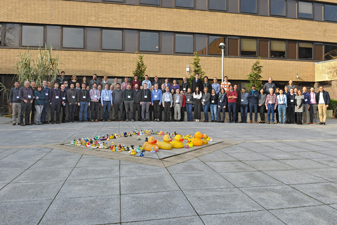
4th workshop on assimilating satellite cloud and precipitation observations for NWP

Europe/London
ECMWF

ECMWF

Reading
Description

#ECJCWS2020


Workshop description

Satellite observations sensitive to cloud and precipitation are key to improving global, regional and convective scale weather forecasts. All-sky assimilation of microwave radiances has been proven through operational assimilation. Further, all-sky infrared and visible radiances are in development, particularly to make use of rapidly updated geostationary observations. Cloud and precipitation radar, cloud lidar and lightning data should all start to contribute to NWP in the next decade. However, the assimilation of cloud and precipitation pushes data assimilation beyond its current design assumptions. Models often have state dependent biases in cloudy areas and do not represent details of the microphysical and sub-grid variability that are needed to drive the observation operators. These, based on scattering radiative transfer, require major simplification to make them fast enough for operational use. The random part of the observation error is dominated by the lack of predictability of cloud and precipitation processes. How can we use increasing satellite instrument resolutions when the predictable scales of cloud are much lower? Further, these predictability or representation errors are correlated in space and time and likely with the background errors, but to diagnose these errors is extremely difficult. The problem is not just correlations, because cloud and precipitation also give rise to nonlinear, non-Gaussian bounded processes and errors. To progress our ability to use cloud and precipitation data we may need to ‘learn’ better physical models and microphysical assumptions, improve fast scattering radiative transfer, and allow data assimilation to handle errors that are non-Gaussian, heterogeneous and heavily correlated.

Sessions and working groups

1.  Assimilating satellite observations sensitive to cloud and precipitation

What are we aiming to get from these observations? How can we achieve this and what more needs to be done?

This session (and WG) sets the scene, overviewing the cloud and precipitation information available from satellites as well as the issues in assimilating it. It includes applications from global to storm-scale nowcasting, and covers the passive microwave, infrared and visible data sources that are already starting to be widely exploited, as well as the emerging use of cloud and precipitation radar and lightning observations. Motivations include medium-range forecasting, initialisation of storms especially for very short range forecasts, and improved knowledge of cloud and precipitation processes. This session will help introduce some of the cross-cutting issues, such as the difficulty of dealing with processes that are unpredictable on small scales, with large biases between model and observations, and the added difficulty of then measuring the forecast improvements brought by cloud and precipitation sensitive observations. For example, could all-sky assimilation do more damage to the forecasted rain bands of hurricanes than it improves them? What kind of verification is needed and in terms of verification data, are the latest satellite precipitation product independent enough of model data to be relevant for being used as reference?

2.  Cloud and precipitation modelling

How can forecast models support cloud and precipitation assimilation, and how can cloud and precipitation assimilation help improve models?

Aims to assimilate cloud and precipitation data often fall at the first hurdle if the errors between model and observations are too great, or if the model does not represent what the observations actually see. This session and WG looks at existing and future microphysics and convection schemes, and the possible development of multi-moment approaches, and the unification of microphysical assumptions with those in the observation operators. To help improve the forecast models we may need to start "learning" more from the assimilated observations. Is this best done as an external loop (model developers look at O-B statistics and tweak parameters?) or an internal loop, through parameter estimation or even machine learning?

3.  Observation operators in cloud and precipitation

How do we go from the forecast model's representation (e.g. hydrometeor water content) to what the observations see?

The observation operator for cloud and precipitation satellite data is usually RTTOV or CRTM, but many others exist. For all of them, what are their current and future capabilities relating to cloud and precipitation? Are they practical for data assimilation applications, meaning are they fast enough, are they memory efficient? What capabilities are missing? How do we represent the often-unknown parameters to which observations are so sensitive, such as size distributions and particle shapes, overlapping cloud layers, sub-field-of-view variability and 3D structures? How can we best quantify the errors associated with the fast and approximate methods used for data assimilation?

4.  Data assimilation methods

How can data assimilation support greater use of cloud and precipitation observations?

Possible methods for cloud and precipitation assimilation include 4D-Var, ensemble Kalman filter, and particle filters: What are their strengths and limitations when it comes to cloud and precipitation? Which domains are they suited to? Ideally observations should be assimilated directly as radiances and reflectivities, but there has been success with 1D-Bayesian approaches. Also, 1D-Var and L2 retrieval assimilation continue to be proposed. How do we represent background errors in cloud and precipitation and what do we choose for our control variables? Observation errors are also critical, but with errors of representation dominant, how do we represent inter-channel and inter-observation correlations, let alone correlations with the background? Is there a need to represent model errors more explicitly, rather than leaving them part of the observation error? For incrementing cloud and precipitation we also need tangent-linear and adjoint models, or alternatives such as incrementing operators, statistical models (such as implicitly used in ensemble Kalman filters) or even machine learning approaches.

Organising committee

•    Alan Geer (ECMWF)
•    Niels Bormann (ECMWF)
•    Thomas Auligné (JCSDA)

Scientific organising committee

•    Stephen English (ECMWF)
•    Richard Forbes (ECMWF)
•    Ben Johnson (JCSDA)
•    Andrew Collard (NCEP)
•    Christophe Accadia (EUMETSAT)
•    Philippe Chambon (Meteo France)
•    Christina Köpken-Watts (DWD)
•    Chiara Piccolo (Met Office)
•    Kozo Okamoto (JMA)
•    Masahiro Kazumori (JMA)


Registration
4th workshop on assimilating satellite cloud and precipitation observations for NWP
Events team
    • 10:30 11:00
      Registration and coffee Weather Room

      Weather Room

    • 11:00 11:10
      Welcome 10m
      Speakers: Andy Brown (ECMWF), Ben Johnson (JCSDA), Christophe Accadia (EUMETSAT)
    • 11:10 11:30
      Workshop organisation 20m
      Speaker: Niels Bormann (ECMWF)
    • 11:30 13:00
      Overview talks
      Convener: Stephen English (ECMWF)
      • 11:30
        Cloud and precipitation assimilation from satellites: 20 years and 4 joint workshops 40m

        With the introduction of improved data assimilation methods around the turn of the millenium, direct assimilation of cloud and precipitation observations became more feasible. Since then, ECMWF-JCSDA workshops have been held every 5 years to assess and progress the state of the art. This talk will overview past progress and introduce the current workshop and its key questions. These are: (1) the observing system, progress in operational all-sky assimilation from nowcasting to global weather forecasting, and the exploitation of a wider array of novel observations including cloud and precipitation lidar, lightning and passive sub-millimetre; (2) progress in cloud micro- and macro-physical modelling - to find out how the models can help constrain observation operators, and how much the observations can help better constrain the models; (3) progress in cloud and precipitation-capable observation operators, particularly the need to handle macrophysical details such as 3D effects and cloud overlap, and microphysical details including the shape, orientation and size distributions of hydrometeors; (4) improved methods for data assimilation, particularly as cloud and precipitation observations challenge many of the assumptions made in current operational systems, particularly the Gaussian and linear assumptions.

        Speaker: Alan Geer (ECMWF)
      • 12:15
        Space-based Cloud & Precipitation Observing Systems in the 2020-2040 Period 40m

        In this presentation, we will go over the evolution of the collective capability to observe cloud and precipitation from space-based observing systems, as planned or envisioned by major international space agencies. We will highlight potential gaps if any and assess its compatibility with the evolution of the global NWP requirements. Both research and operational missions will be explored, as well as potential missions of opportunities from non-governmental entities. We will attempt to cover capabilities from microwave (active and passive) as well as infrared sensors. The capabilities that will be covered in this presentation will include the ability to measure the suspended cloud and the precipitating water in all phases but will also cover the additional characteristics that are critical for meteorological and hydrological applications such as global NWP: these include temporal update rate, spatial coverage, footprint resolution and vertical resolution. We will be targeting the 2020-2040 timeframe when assessing the capabilities.

        Speaker: Dr Sid Boukabara (NOAA)
    • 13:00 14:00
      Lunch break 1h
    • 14:00 16:30
      Session 1a: Assimilating satellite observations sensitive to cloud and precipitation
      Conveners: Brett Candy (UK Met Office), Katrin Lonitz (ECMWF)
      • 14:00
        All-sky infrared assimilation overview 40m

        This presentation intends to cover recent development of all-sky infrared assimilation in the research and operational system. Development on all-sky IR assimilation have been recently significantly progressed although it has not yet been implemented in operational systems. Studies showed the value of frequent measurement of all-sky infrared radiances from new generation geostationary satellites in regional assimilation systems. Some global assimilation studies also showed positive impacts of assimilating all-sky radiances of hyperspectral sounders and geostationary imagers. The ongoing developments, issues and achievements of all-sky infrared assimilation will be overviewed based on the information given by operational centers and recent publications.

        Speaker: Dr Kozo Okamoto (JMA/MRI)
      • 14:45
        Overview of the assimilation of microwave imagers and humidity sounders observations within clouds and precipitation 40m

        Microwave observations are characterized by a very rich information content with respect to water in all its different states, from water vapor to condensed water mass. Various developments in the past decade, including major advances regarding radiative transfer, allowed the assimilation of microwave observations within clouds and precipitation. The international community gained a lot in understanding of the mechanisms which can lead to progresses onto forecasts with microwave cloudy and rainy observations, at various scales from large scale global forecasts to kilometric scales with mesoscale regional forecasts.

        This presentation will attempt to review the use of the various microwave observing systems which have been experimented for all-sky assimilation and did or did not make it yet to an operational system. Impacts reported by several operational and research centers from the use of microwave imagers and humidity sounders will be summarized, with a particular focus on extreme events. Some current limitations and challenges of microwave assimilation will be discussed like the tuning of radiative properties of hydrometeors within observation operators. Finally, verification methods for measuring the progresses made through microwave all-sky assimilation will be discussed with a particular focus on precipitation forecasts.

        Speaker: Philippe Chambon (Météo-France)
      • 15:30
        All-sky assimilation of temperature-sounding microwave data 25m

        Satellite radiances affected by cloud and precipitation are usually associated with meteorologically important regions. As research development has been intensified in the past decade in major NWP centers on the use of all-sky radiance observations, the assimilation of cloudy radiances from the Advanced Microwave Sounding Unit-A (AMSU-A) for ocean fields of view became operational in the hybrid 4D Ensemble-Variational (EnVar) Global Forecast System (GFS) at Environmental Modelling Center (EMC) at NCEP in 2016. Later, with the implementation of the FV3 GFS data assimilation system in 2019, the all-sky assimilation was expanded to the radiances of Advances Technology Microwave Sounder (ATMS). To deal with model errors, especially the errors of clouds, only selected data sample was used in the variational radiance bias correction scheme and situation-dependent observation error inflation was applied. The all-sky radiance assimilation has improved GFS analysis and forecast. The configuration of the all-sky radiance assimilation at NCEP, with the flow-dependent background error covariance provided by the ensemble forecasts, will be presented. The application of VIIRS cloud products in the all-sky microwave data quality control will also be briefly discussed. In addition, efforts have been invested at EMC on the all-sky assimilation of radiances sensitive to land, and the status and progress of this work will be given. At the workshop, a brief overview of other AMSU-A assimilation work (e.g. Met Office and ECMWF) will be presented as well.

        Speaker: Dr Yanqiu Zhu (NOAA)
      • 16:00
        Assimilation of visible data: Experiments with convective-scale NWP 25m

        Observations in the visible range contain a wealth of information which is in many ways complementary to measurements from thermal infrared and microwave sounders. Radiances or reflectances in the visible can see low clouds and fog as well as small scale clouds and also provide data of cloud characteristics themselves. Therefore these data, represent an important data source for assimilation.
        Also, for convective-scale NWP, convective precipitation and cloud cover are among the most challenging user-relevant predicted variables. Therefore, given the availability of geostationary imager data at high spatial and temporal resolution, we see great potential for improving the representation of these processes through assimilating visible channels. The aim is to better represent convective situations already at the stage of convective initiation where clouds usually form at low levels and at small scales as well as low cloud situations like winter stratus. Using visible channels for this purpose is enabled through the new fast and accurate forward operator MFASIS (Scheck et. al, 2016), which has recently also been implemented into RTTOV.
        The current work is part of the development of a seamless forecasting system with the aim to transition smoothly from observation based nowcasting to short range NWP. Assimilation experiments use the SEVIRI/MSG 0.6 µm channel with the Kilometre scale ENsemble Data Assimilation (KENDA) based on an Local Ensemble Transform Kalman Filter formulation (LETKF, Schraff et. al, 2016). Experiments are done with the COSMO model as well as the new limited area version of ICON (ICON-LAM), currently being implemented at DWD. The focus is on the improvement obtained for cloud cover, precipitation and surface variables. Furthermore, we discuss various assimilation challenges related to vertical localization and ambiguities of the observations, as well as gaussianity of first guess departures and non-linearity of the forward operator.
        Additionally to the convective-scale assimilation, visible reflectances are also used with the global ICON model. As a first step, this part of the work focuses on analysing and further improving the MFASIS operator and its RTTOV implementation over the full range of atmospheric situations and on evaluating model clouds using visible channels.

        Speaker: Christina Köpken-Watts (DWD)
    • 16:30 17:30
      Poster session with self-serve tea and coffee

      Posters will remain up all week and coffee breaks will be taken among posters

    • 17:30 19:00
      Icebreaker with posters
    • 09:00 10:00
      Session 1a: Assimilating satellite observations sensitive to cloud and precipitation
      Conveners: David Duncan (ECMWF), Shunji Kotsuki (Chiba University)
      • 09:00
        Cloudy IR assimilation at the Met Office 25m

        Work is under way at the Met Office to develop a new all-sky assimilation scheme for infrared radiances from hyperspectral sounders. The aim is to assimilate IR radiances in the majority of cloudy scenes using the multiple-scattering capabilities available in RTTOV. Using a variable observation error model, it is hoped that this will lead to both a significant increase in the usage of IR radiances and useful improvements in NWP performance. This talk will describe the background and progress so far, details of the methodology and some preliminary forecast impact experiments.

        Speaker: Ed Pavelin (Met Office)
      • 09:30
        Assimilating All-Sky Microwave Brightness Temperature Data to Improve NASA GEOS Forecasts and Analyses 25m

        The NASA Global Modeling and Assimilation Office (GMAO) has been pursuing efforts to utilize all-sky (clear+cloudy+precipitating) MW radiance data and has developed a system to assimilate all-sky GPM Microwave Imager (GMI) radiance data in the Goddard Earth Observing System (GEOS) during the last PMM funding period. The system provides additional constraints on the analysis process near the storm regions and adjusts the geophysical parameters such as precipitation, cloud, moisture, surface pressure, and wind by combining information from GMI radiance measurements and model forecasts in an optimal manner. The system proved that assimilating the GMI all-sky radiance data improve the GEOS atmospheric analyses and forecasts. This all-sky data framework has been included in the GEOS Forward Processing (FP) system since July 11, 2018 and assimilates all-sky GMI data in real-time for GEOS global analysis and forecast production at the GMAO. We are currently extending this all-sky GMI radiance data assimilation system to assimilate more all-sky MW radiance data from other sensors such as the Microwave Humidity Sounder (MHS), the Advanced Technology Microwave Sounder (ATMS), the Special Sensor Microwave Imager/Sounder (SSMIS), Advanced Microwave Scanning Radiometer 2 (AMSR2), and the Sounder for Atmospheric Profiling of Humidity in the Intertropics by Radiometery (SAPHIR) onboard the GPM constellation spacecrafts. Preliminary results from this extended all-sky system show increased benefit from cloud- and precipitation-affected MW radiances with much larger spatial and temporal coverages compared to the all-sky system assimilating GMI alone and improved GEOS forecast skills especially for lower tropospheric humidity fields.

        Speaker: Dr Min-Jeong Kim (NASA GMAO/Morgan State University)
    • 10:00 10:30
      Coffee break 30m
    • 10:30 12:00
      Session 1b: Emerging observations
      Conveners: David Duncan (ECMWF), Shunji Kotsuki (Chiba University)
      • 10:30
        Ice cloud imager (ICI) and microwave imager (MWI) 25m

        The second generation of the EUMETSAT Polar System (EPS-SG) will include the Micro-Wave Imager (MWI) and the Ice Cloud Imager (ICI) conically-scanning radiometers that will be flown on the Metop-SG B satellites.
        MWI will have 18 channels ranging from 18 to 183 GHz. The frequencies at 18.7, 23.8, 31.4 and 89 GHz provide continuity to key microwave imager channels for weather forecasting and surface parameter retrieval. MWI includes also innovative set of channels near 50–60 GHz and at 118 GHz, sensitive to weak precipitation and snowfall. Dual polarisation is implemented up to 89 GHz, at higher frequencies only vertical polarisation will be provided.
        ICI is a novel mission, the first operational radiometer of this type designed for the remote sensing of cloud ice. ICI will have 11 channels in the mm/sub-mm spectrum from 183 GHz to 664 GHz. Three sets of channels will sample the water vapour absorption lines around 183, 325 and 448 GHz and two channels are in the atmospheric windows at 243 and 664 GHz. The window channels are implemented with dual polarisation, while the other channels are vertically polarised only. The ICI will provide an innovative characterisation of clouds, with information on humidity and ice hydrometeors, particularly the bulk ice mass.
        The channel and scanning characteristics of both instruments will be detailed, and the activities related to the preparation of the operational products will be discussed.

        Speaker: Mr Christophe Accadia (EUMETSAT)
      • 11:00
        Dual-frequency precipitation radar (DPR) for NWP data assimilation 25m

        A reflectivity data assimilation technique has been developed to enhance GPM/DPR assimilation in JMA. The data assimilation method is hybrid-4DVar using flow-dependent background-errors estimated from ensemble perturbations. This 4D-Var includes TL/AD of 3-ice cloud microphysics scheme as a strong constraint. In the TL of cloud microphysics scheme, the perturbations of thermodynamic variables were ignored and some approximations to prevent numerical divergence was implemented. As a result, the TL became possible to predict the linear-perturbation of hydrometeors while maintaining the practically sufficient accuracy during the 3-hour assimilation window in the system.

        In addition, a radar simulator as observation operators has been developed. A function to simulate the melting layer and an artificial noise-filter to reproduce the detection limit of radar were implemented into the simulator. Using the radar-simulator and RTTOV, we verified the predictions of the operational regional NWP model of JMA called MSM against GPM satellite observation data. Compared to DPR, the amount of rain in the lower troposphere was underestimated, and compared to GMI using RTTOV-SCATT, the amount of cloud ice was further underestimated. We found that the reasons for the underestimation were due to the large evaporation rate of rain and the large conversion rate of cloud ice into snow. These errors were successfully reduced by revision to the PSD for rain and the conversion methods between water species. This improvement has a large impact not only for the nonlinear model forecasts but also for the TL predictions for hydrometeors.

        In the presentation, I would like to demonstrate the impact of assimilation for GPM in the system including the modifications mentioned above.

        Speaker: Yasutaka Ikuta (Japan Meteorological Agency)
      • 11:30
        Cloud radar and lidar assimilation at ECMWF 25m

        Cloud related observations, such as those from microwave radiances, have been at the forefront of recent developments in assimilation, but contain limited information on the vertical structure of clouds. Active observations from profiling instruments such as cloud radar or lidar contain a wealth of information on the structure of clouds and precipitation, providing the much-needed vertical context of clouds, but have never been assimilated in global NWP models. Inspired by the success of previous experiments, in which CloudSat radar reflectivity and Calipso attenuated backscatter profiles were indirectly assimilated via pseudo-observations of temperature and humidity, the European Centre for Medium-range Weather Forecasts (ECMWF) 4D-Var system
        has been adapted to allow their direct assimilation.

        In this presentation, several important developments required to prepare the data assimilation system for the new observations of cloud radar reflectivity and lidar backscatter will be summarized. This includes the specification of sufficiently accurate observation operators, i.e. models providing equivalent model fields to observations. Another important aspect is observation error definition; the observation error of cloud observations is highly situation dependent, so a flow-dependent error model will be presented that accounts for both the spatial representativity error and the uncertainty in the microphysical assumptions. In addition, for the proper handling of observations in the context of an assimilation system, an appropriate quality control strategy and bias correction scheme are required and will also be discussed. Finally, the potential of EarthCARE data for directly improving weather forecasts by assimilating cloud radar and lidar observations into a global NWP model will be demonstrated. Prospects for increasing the direct benefit of cloud radar and lidar assimilation will also be discussed.

        Speaker: Marta Janiskova (ECMWF)
    • 12:00 13:00
      Working group 1 panel (Ulrich Blahak, Steve English, Nadia Fourrié, Jason Otkin) and plenary
      Conveners: Andrew Collard (IMSG@NOAA/NCEP/EMC), Peter Weston (ECMWF)
    • 13:00 14:00
      Lunch break 1h
    • 14:00 17:15
      Session 2: Cloud and precipitation modelling
      Conveners: Philippe Chambon (Météo-France), Ulrich Blahak (Deutscher Wetterdienst)
      • 14:00
        Observation-informed model development for cloud and precipitation 40m

        The representation of clouds, precipitation and their impacts are fundamental for weather forecasting and climate, yet many regime-dependent systematic errors continue to be present in global atmospheric models. There are a wealth of data from passive and active satellite instruments that can help to identify and understand the causes of these errors. In particular, monitoring and assimilation of cloud- and precipitation-sensitive satellite observations in an NWP data assimilation framework is an under-utilised source of information for physical parametrization development.

        This presentation will discuss model cloud and precipitation evaluation with satellite observations, highlighting how the evaluation can lead to identification and improvement of specific parametrized processes, such as rain formation and cloud glaciation. A number of examples with the ECWMF global NWP Integrated Forecast System (IFS) will be shown. First guess departures from the assimilation of all-sky microwave channels sensitive to liquid water path continue to play an important role in reducing cloud and radiation errors over the marine stratocumulus and extra-tropical storm tracks. Active observations from radar and lidar (CloudSat/CALIPSO) continue to be highly valuable for evaluating many aspects of the cloud and precipitation fields.

        Looking to the future, there is potential for extracting much more information on cloud and precipitation from active and passive satellite observations across the electromagnetic spectrum, and a question to what extent the properties of the global cloud and precipitation fields can be constrained by observations from space.

        Speaker: Richard Forbes (ECMWF)
      • 14:45
        Recent developments in microphysical modelling 25m

        This presentation will discuss the most recent developments of the Thompson-Eidhammer aerosol-aware bulk microphysics parameterization in the Weather Research and Forecasting (WRF) model. Detailed comparisons of many types of observed data have been used to improve the scheme over numerous years including satellite, radar, surface, and aircraft observations. The most recent observational data comparison came from an aircraft field campaign in winter 2019 in the Great Lakes region of the United States versus a WRF model run in real time to support flight planning using a 600-meter grid increment. Also a new technique to improve cloud initialization was incorporated in the absence of a full-scale data assimilation system. Further improvements leveraging the latest satellite data resources can provide aerosol, cloud particle phase and size retrievals to make larger improvements. A specific focus of the presentation will be the prediction of supercooled liquid water clouds and very hazardous freezing drizzle conditions. The former is a well-known shortcoming of nearly all global circulation models and the latter is a significant aviation hazard.

        Speaker: Dr Gregory Thompson (NCAR-RAL)
      • 15:15
        Beyond bulk cloud top quantities: A climate perspective on using satellite observations (and assimilation) to better inform cloud simulation 25m

        The challenges of cloud modeling in large scale models and for climate time scales (sub-seasonal to centuries) will be explored. Key problems related to clouds in longer term climate prediction include extreme precipitation, climate forcing and cloud feedbacks. Satellites provide a wealth of data on clouds that are used for evaluation of models in many different ways. Examples of innovative approaches to using data will be shown, with a discussion of the current generation of passive and active sensors, as well as some prospects for the future observation systems, and how they can be better integrated with models for weather and climate.

        Speaker: Andrew Gettelman (NCAR)
      • 15:45
        Coffee break 30m
      • 16:15
        Biases in all-sky data assimilation: ignore, screen, correct? 25m

        This talk will give an overview of the cloudy and rainy biases our community have to face in order to assimilate all-sky satellite data successfully. Furthermore, we will discuss which different options have been explored or are in the pipeline to treat all-sky biases.
        One option would be either to ignore or to screen the data in the presence of model bias. For example, at ECMWF the all-sky assimilation of microwave radiances revealed a lack of supercooled liquid water in cold-air outbreak regions over ocean, which explained a long-standing bias in the short wave net radiation. Using this data would degrade the forecast and while work is in progress to resolve this model bias, the affected microwave data is screened in the mean-time. Another option to tackle all-sky biases is using bias correction schemes. To our knowledge, most NWP centres do not use specific cloud or precipitation predictors for the all-sky assimilation. At the MetOffice, work is in progress in developing a selective VarBC for MHS channels 3, 4 and 5 where only a subset of radiances are chosen for bias correction, e.g. clear-sky only radiances. This is motivated by findings showing a bias for scenes affected by frozen cloud. A number of other centres and research groups also have to deal with biases and these strategies will also be covered. Which option in treating biases in the all-sky assimilation is best ultimately depends on the source of the bias and how the all-sky data is used inside the assimilation system.

        Speaker: Katrin Lonitz (ECMWF)
      • 16:45
        Lightning modelling and assimilation 25m

        A lightning parametrization was developed at ECMWF, which became operational in June 2018. It can predict total lightning flash densities (cloud-to-ground plus cloud-to-cloud) both in the deterministic and the ensemble forecasting system. Its tangent-linear and adjoint versions were also developed and have been used over the past two years to investigate the possibility to assimilate lightning flash observations from the new GOES-16 Geostationary Lightning Mapper (GLM) using the 4D-Var approach. This presentation will describe the lightning parametrization, its validation as well as the first results from the assimilation of lightning observations in ECMWF's 4D-Var system. Issues that are specific to the assimilation of lightning data in a variational context will also be summarized.

        Speaker: Dr Philippe Lopez (ECMWF)
    • 17:15 18:00
      Working group 2 panel (Olivier Caumont, Andrew Gettelman, Derek Posselt, Greg Thompson) and plenary
      Conveners: Derek Posselt (Jet Propulsion Laboratory), Richard Forbes (ECMWF)
    • 18:00 19:00
      Pre-dinner drinks 1h
    • 19:00 21:00
      Workshop dinner at ECMWF
    • 09:00 12:00
      Session 3: Observation operators
      Conveners: Eugene Clothiaux (Pennsylvania State University), Dr Stefan Kneifel (University of Cologne)
      • 09:00
        Recent advances in the Community Radiative Transfer Model (CRTM) in support of all-sky radiance assimilation 25m

        The Joint Center for Satellite Data Assimilation (JCSDA) Community Radiative Transfer Model (CRTM) is a fast, 1-D radiative transfer model used in numerical weather prediction, calibration / validation, etc. across multiple federal agencies and universities. The key benefit of the CRTM is that it is a satellite simulator, in that it provides a highly accurate representation of satellite radiances by making appropriate use of the specific sensor response functions convolved with a line-by-line radiative transfer model (LBLRTM). CRTM covers the spectral ranges consistent with all present operational and most research satellites, from visible to microwave. The capability to simulate ultraviolet radiances are being added over the next two years.
        Another unique aspect of the CRTM is that it also provides the tangent-linear, adjoint, and Jacobian outputs needed for satellite data assimilation applications. The ability to compute a Jacobian for various geophysical input parameters significantly expands the capabilities beyond traditional forward RT models, such as those used in remote sensing retrieval algorithms and other "Bayesian" or "1D-VAR" applications.

        The present talk will focus on recent advances in the ability of the CRTM to simulate satellite radiances in the presence of cloudy and precipitating scenes, with a particular emphasis on ice-phase microphysics. We'll explore the radiance sensitivity to cloud microphysical parameters through a series of experiments that will form the basis of the next generation of operational satellite data assimilation and numerical weather prediction. This represents a significant and necessary expansion of the CRTM capabilities to perform in an all-weather, all-surface, all-sensor environment.

        Speaker: Dr Benjamin Johnson (Joint Center for Satellite Data Assimilation)
      • 09:30
        Uncertainty characterization of sub-mm and MW in all-sky radiative transfer 25m

        Nowadays, satellite microwave (MW) observations are gaining weight in weather and climate applications. The upcoming Ice Cloud Imager (ICI) mission covering frequencies between 183 and 670 GHz aims at improving the representation of cloud ice in models. Ultimately, ICI will extend the scope of MW assimilation. In stand-alone retrievals and data assimilation, several simplifications are still employed. Particularly, particle size distributions (PSDs) and particle models (PM) of ice hydrometeors are poorly considered and three-dimensional (3D) radiative transfer is ignored. Thus, an assessment of these simplifications was conducted by means of ARTS (Atmospheric Radiative Transfer Simulator). A framework was developed, employing the ARTS scattering database and generating synthetic scenes based on CloudSat observations over Tropics. Firstly, we evaluated the performance of different PMs and PSDs to model observations by GMI (GPM Microwave Imager) and the impact to the derived ice water content is assessed. At frequencies between 186 and 190 GHz and above 180 K, the simulated brightness temperature is fairly insensitive to PM. However, at lower temperatures, large discrepancies are found, with no clear indication which PM performs best. Of tested PSDs, McFarquhar and Heymsfield (1997) provides the best agreement to GMI. The analysis was extended towards the highest frequencies of ICI (above 328.65 GHz) and revealed a higher sensitivity to the assumed PM with great potential for constraining ice properties. Secondly, an effort was conducted to quantify the errors induced by neglecting 3D effects, i.e., horizontal photon transport (HPT) and beam-filling (BF), at mm/sub-mm wavelengths of current and proposed satellite instruments. The analysis reveals a small HPT effect introducing mostly random errors and an overestimation (below 1 K), while a substantial BF effect that increases with frequency and footprint size. Overall, the BF effect can be up to 4 and 13 K at 183.6 and 668 GHz, respectively.

        Speaker: Dr Vasileios Barlakas (Chalmers University of Technology)
      • 10:00
        Fast infrared modelling of cloudy infrared radiances 25m

        Cloudy infrared observations are not currently fully exploited in operational NWP models. There are many reasons for this and the one we are interested in is the need to have an accurate and fast radiative transfer model to simulate cloud scattering in infrared. In most NWP centers, cloudy infrared observations are assimilated using the grey-cloud approximation. In this approximation clouds are considered as a single opaque layer without any scattering. By assuming this, cloudy simulations are very fast but only information on the atmosphere above the cloud top is gained in the assimilation, then excluding in-cloud information. Furthermore, the selection of observations to overcast situations reduces drastically the percentage of assimilated cloudy observations estimated between 3 and 5%. In order to go a step beyond the single layer opaque cloud model, fast infrared modelling of cloudy radiances including scattering have been proposed for many years in radiative transfer models. The three contributors to the fast infrared modelling of cloudy radiances will be discussed: fast scattering models, cloud optical properties and cloud overlap methods.

        Speaker: Jerome Vidot (Météo-France)
      • 10:30
        Coffee break 30m
      • 11:00
        Fast methods for simulating visible satellite images 25m

        Visible satellite images provide high-resolution information on
        clouds. However, so far they have not been assimilated directly for
        operational purposes, as multiple scattering dominates in the visible
        spectral range and makes radiative transfer computations with standard
        methods complex and slow. Only recently, sufficiently fast and
        accurate forward operators have become available. Here we report on
        the design of a lookup-table based forward operator and developments
        aimed at increasing its accuracy. Approximations for three-dimensional
        radiative transfer effects and corrections for mixed-phase clouds are
        addressed. Moreover, the potential of alternative approaches based on
        machine learning is discussed. These approaches could be competitive
        in terms of speed and accuracy and allow for including
        additional radiative transfer effects and aerosols.

        Speaker: Dr Leonhard Scheck (Hans-Ertel Centre for Weather Research, LMU Munich)
      • 11:30
        Is it possible to find average snow scattering properties that can be applied globally? A first attempt using Self-similar Rayleigh Gans Theory and a new aggregation model 25m

        The assimilation of all-sky radiance data requires a fast and accurate radiative transfer model capable of simulating the scattering and absorption effects of hydrometeors. In the past decade, complex Discrete Dipole Approximation (DDA) scattering calculations have demonstrated that commonly used simplifications in frozen particle shape (i.e., sphere and spheroids) are insufficient for representing the snow scattering properties across multiple microwave frequencies and that the internal snowflake microstructure plays an important role in the definition of the scattering effects. Nonetheless, abandoning the simplified spheroidal shape model opens a whole new problem that is deciding which ice particle shape is the most realistic out of the enormous variety of natural ice particles.
        Recently, microphysical schemes used in weather models have made a lot of progress in representing the natural variability of snow properties. The consistency of scattering calculations with such spread of assumptions is difficult to ensure with DDA datasets.
        The Self-Similar Rayleigh-Gans Approximation (SSRGA) has been developed as a tool to estimate the scattering properties of self-similar ensembles of snowflakes. The power of SSRGA relies on the fact that it takes the form of an analytic function and can easily calculate the scattering properties of realistically shaped snowflakes for various sizes, mass-size relations, aspect-ratios and for any frequency.
        Using a realistic snow particle model, we have derived the SSRGA parameters of various types of snowflakes. We have tested the simulated scattering properties against a long-term dataset of multi-frequency ground-based radar measurements. The particle habit that most consistently matched our observations is a snow aggregate composed of a mixture of dendrites and columnar prisms. The results of this study also confirm that it is possible to constrain the microwave scattering properties of frozen particles by means of a statistical comparison of simulated and observed microwave measurements.

        Speaker: Davide Ori (University of Cologne)
    • 12:00 13:00
      Working group 3 panel (Mark Fielding, Ziad Haddad, Emily Liu, Marco Matricardi) and plenary
      Conveners: Ben Johnson (JCSDA), Robin Hogan (ECMWF)
    • 13:00 14:00
      Lunch break 1h
    • 14:00 17:00
      Session 4: Data assimilation methods
      Conveners: Dr Christina Köpken-Watts (Deutscher Wetterdienst), William Campbell (U.S. Naval Research Laboratory)
      • 14:00
        Background errors and control variables for clouds and precipitation 25m

        Thanks to their explicit microphysical parameterization, non-hydrostatic Cloud Resolving Models (CRM) allow realistic representations of non linear diabatic processes. Forecast errors of thermodynamical variables and hydrometeors can be computed specifically in cloudy and precipitating conditions by applying e.g geographical masks to ensemble of forecasts obtained with such CRMs and by performing statistics on forecast differences. The resulting covariances generally strongly differ from climatological statistics that are used in operations, which demonstrate that observations performed in those conditions, as those from e.g Doppler Radar and microwave radiometers, are clearly under-exploited. Such covariances are indeed clearly flow-dependent and are characterized by strong inhomogeneities and by non-Gaussianities. Change of variables may be considered at that point to work with more Gaussian pdfs. Illustrations will be given for different meteorological phenomena such as strong convective cases or fog. Studies have shown that specific background error covariances can be modeled in those conditions (and thus used in purely variationnal DA techniques), but frequent updates are required. When considering hydrometeors in the Control Variable (CV), modeled covariances are however hardly usable, as their spatial inhomogeneities are enhanced and furthermore vertically stratified.

        To account for these flow dependencies in a deterministic DA process, a direct approach consists in sampling background error covariances from an ensemble of forecasts run in parallel and to use them in sequential (e.g. EnKF) or in variationnal (e.g. EnVar) DA systems. In those methods, an important step consists in reducing the sampling noise by applying localization functions, which aim to damp sampling noise of the covariances with distance. Localization length-scales can be directly diagnosed in the model space from the ensemble and geographical masks can also be used to compute specific values for hydrometeors. Here again, great variability between variables occurs, especially for the latter variables. Illustrations will be given by using background error perturbations from the operational EDA based on AROME-France, which is run at Météo-France with at 3.2 km horizontal resolution. Such localization length-scales can then be exploited in an EnVar context.

        Even without direct observations of cloud and precipitation related variables, increments of hydrometeors can be obtained from those DA algorithms thanks to the background error cross-covariances between control-variables. Such cross-covariances allow indeed to project increments of thermodynamical variables implied by the assimilation of e.g. Doppler wind and pseudo-profiles of relative humidity deduced from the Radar reflectivities onto those of hydrometeors. Improvements in the forecast of cloud coverage and accumulated precipitation have been obtained considering such covariances within an EnVar applied to AROME, but for very short ranges. Many challenges remain to reduce the spin down effect and to get more lasting impacts. Favorable analyzed thermodynamical conditions may be key aspect, as hydrometeors are transient by nature. Moreover, the assumptions made in classical DA, especially the linearity of the prominent processes and the Gaussianity of uncertainties’s pdf, are likely to be violated to some degree. Some options that may help will be finally discussed.

        Speakers: Thibaut Montmerle (Météo-France), Mayeul Destouches (CNRM (Météo-France/CNRS))
      • 14:30
        Treatment, Estimation, and Issues with Representation Error Modelling 25m

        Data assimilation schemes blend observational data, with limited coverage, with a short term forecast to produce an analysis, which is meant to be the best estimate of the atmospheric state. Appropriately specifying error statistics is necessary to obtain an optimal analysis. However, observations often measure a higher resolution state than coarse resolution model grids can describe. Hence, the observations may measure spatial or temporal scales or physical processes that are poorly resolved by the filtered version of reality represented by the model. This inconsistency, known as observation representation error, must be accounted for in data assimilation schemes. Further, representation error is a key, if not dominant, contributor to correlated observation errors which are often neglected.
        This talk will provide an overview of current methods for estimating observation error and their ability to diagnose error of representation. Shortcomings of these methods will be addressed, including the implications of non-zero correlations between the background and observation error. Finally, we will discuss recent methods that aim to include flow dependence in the representation error model.

        Speaker: Dr Elizabeth Satterfield (Naval Research Laboratory)
      • 15:00
        How to make changes in hydrometeors at the observation location - adjoints, incrementing operators and ensemble correlations 25m

        The quality of a numerical weather prediction (NWP) system depends on the reliability of its forecasts in both its deterministic and probabilistic configurations. Forecast skill then is affected by the accuracy of the NWP model and its physical parametrizations, as well as by initial condition errors, which include the contributions from observation errors, both random and systematic. It follows that one of the avenues to improve the NWP scores is to assimilate more observational information, particularly on water in its different phases due to its high spatial variability and relatively high forecast uncertainty.

        This is why all major NWP centres are currently assimilating satellite microwave radiances in all-sky conditions and have plans to extend their all-sky assimilation system to infrared radiances. However, a critical condition to benefit from observational information is to be able to estimate increments in all relevant cloud and precipitation forecast fields. In a hybrid variational data assimilation system, these updated fields need to be given as input to observation operators as well as to tangent linear (or perturbed forecast) and adjoint models. This can be achieved using one or more cloud control variables as well as a complete description of the forecast fields as part of the forecast ensemble used to describe flow-dependent forecast errors. In alternative to cloud control variables it is possible to make use of physical-statistical relationships to distribute increments to a single control variable. Finally, water increments can arise from moist physics parametrizations, both in their nonlinear and linearized configurations.

        In this talk an outline of the design of the moist control variables, moisture incrementing operator and tangent linear physics that are currently operational at the Met Office and other operational centres will be provided.

        Speaker: Stefano Migliorini (Met Office)
      • 15:30
        Coffee break 30m
      • 16:00
        Challenges propagating innovations on precipitation and cloud to other state variables 25m

        In the presence of clouds and precipitation, there is a greater need for information on all state variables in a context where both data assimilation and remote sensing become more complicated, because:

        1) Clouds, and to a lesser extent precipitation, shut atmospheric windows at optical (UV to IR) and upper-microwave frequencies while also introducing challenges to observation simulation, limiting the number of high-quality constraints that can be obtained via many remote sensing approaches;

        2) Errors grow faster in areas of atmospheric instabilities that often cause clouds and precipitation to appear and evolve, making precipitation the least predictable of atmospheric properties;

        3) Clouds and precipitation fields have greater errors, especially at smaller scales, than other fields. Because smaller-scale errors dominate, they are correlated with errors in other fields over shorter distances, limiting the benefit of information propagation that is the key to successful data assimilation. In addition, fields at small scales are not as well simulated by models of limited resolution, making any observation innovation both harder to reproduce by measurement simulation and to use for assimilation;

        4) The information propagation component of many common traditional assimilation approaches often assumes a linear correlation of errors, an approach that works better given small background errors, a rarer situation in precipitating areas;

        5) Innovations in precipitation have the least benefit for forecasting the future evolution of the atmosphere as, by definition, precipitation quickly gets out of the atmosphere. Successful precipitation forecasting relies more on improving the other state variables than on improving precipitation fields;

        All this occurs while we also have two additional categories of model state variables to characterize, cloud and precipitation properties, that are otherwise trivial to set in the absence of clouds.

        This state of affairs calls for the exploration of approaches better designed to handle such difficult situations.

        Speaker: Frederic Fabry (McGill University)
      • 16:30
        Particle filters for convective-scale assimilation 25m

        Roland Potthast, Anne Walter, Andreas Rhodin, Nora Schenk, Liselotte Bach, Takemasa Miyoshi, Shunji Kotsuki, Peter Jan van Leeuwen

        We discuss the development of non-linear filtering methods for very high-dimensional systems. In this talk, non-linear filtering is developed in the framework of the convective-scale ensemble data assimilation system ICON-KENDA of DWD with upcoming 2km operational resolution at DWD. ICON-KENDA will also be used by the COSMO consortium (Germany, Switzerland, Italy, Russia, Poland, Romania, Greece and Israel) and its partner countries to provide initial conditions for high-resolution ensemble forecasting systems. We have ported the particle filter to the new ICON-D2 model framework, also including incremental analysis update (IAU). We also discuss recent experiments with conventional plus SEVIRI all-sky Satellite data in the visible range.

        In a broader framework, we discuss ongoing research and results on the localized adaptive particle filter (LAPF) and a Localized Mixture Coefficient Particle Filter (LMCPF). We discuss how to overcome filter collapse or divergence by adaptive rejuvenation by mapping into ensemble space and by using adaptive spread estimators. Recent progress is shown on the LMCPF particle filters for Lorenz 63 and 96 models, where now with Gaussian mixture particles and proper covariance inflation the particle filter usually shows comparable or better o-b statistics than the LETKF. We also discuss recent activities on localised particle filter implementations at RIKEN, Japan.

        Speaker: Prof. Roland Potthast (DWD)
    • 17:00 18:00
      Working group 4 panel (Elias Holm, Takemasa Miyoshi, David Simonin, Olaf Stiller) and plenary
      Conveners: Craig Bishop (The University of Melbourne), Massimo Bonavita (ECMWF)